![]()
Uh oh, the deal has ended
Don't miss out again, get the latest news via
![]()
| Starts | 31 Dec 2024 (Tue) | Ends | 1 Jan 2025 (Wed) |
|---|---|---|---|
| Location | Not Specified |
 We are now on WhatsApp Channel. Click to join We are now on WhatsApp Channel. Click to join |
Due to closure of certain roads and lanes around Marina Bay on New Year’s Eve, the public is encouraged to make their way to Marina Bay Singapore Countdown 2025 via the island-wide Mass Rapid Transit (MRT) system.
Certain roads and lanes in and around Marina Bay will be closed during particular timings from 31 December to 1 January. Members of the public travelling to and from Marina Bay Singapore Countdown 2025 are advised to take the public transport.
Train services will be extended on 31 December 2024. You may check the SMRT and SBS Transit websites for the latest changes in operating hours.
All MRT lines (East-West Line, North-South Line, Downtown Line, Circle Line and Thomson-East Coast Line) have stops in the Marina Bay area. The nearest stations are:
- Marina Bay (NS27/TE20/CE2)
- Raffles Place (NS26/EW14)
- City Hall (NS25/EW13)
- Shenton Way (TE19)
- Downtown (DT17)
- Bayfront (DT16/CE1)
- Promenade (DT15/CC4)
- Esplanade (CC3)
- Gardens by The Bay (TE22)
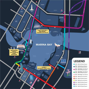
Overview of Road Closures on New Year’s Eve
| S/N | Roads and Lanes affected | Period of closure |
|---|---|---|
| 1. | Bayfront Avenue (between Temasek Avenue and lamp post 34F) | 31 December 2024 6pm to 2am the following day |
| 2. | The slip road leading from Bayfront Avenue into Raffles Avenue | |
| 3. | Esplanade Drive in the direction of Fullerton Road (between Nicoll Flighway and Fullerton Road) | |
| 4. | Fullerton Road (between lamp post 18 and Esplanade Drive) | |
| 5. | The extreme left lane of Fullerton Road in the direction of Collyer Quay (between Esplanade Drive and Collyer Quay) | 31 December 2024 6pm to 9pm |
| 6. | The extreme left lane of Collyer Quay in the direction of Raffles Quay (between Fullerton Road and Collyer Quay) | |
| 7. | The extreme right lane of Esplanade Drive in the direction of Nicoll Highway (between Fullerton Road and Nicoll Highway) | 31 December 2024 6pm to 10pm |
| 8. | Fullerton Road in the direction of Collyer Quay (between Esplanade Drive and Collyer Quay) | 31 December 2024 9pm to 2am the following day |
| 9. | Collyer Quay in the direction of Raffles Quay (between Fullerton Road and Collyer Quay) | |
| 10. | Esplanade Drive in the direction of Nicoll Highway (between Fullerton Road and Nicoll Highway) | 31 December 2024 10pm to 2am the following day |
| 11. | Marina Boulevard (between Raffles Quay and Bayfront Avenue) | |
| 12. | Raffles Avenue (between Temasek Avenue and Nicoll Highway) | |
| 13. | The slip road leading from Raffles Avenue into Esplanade Drive | |
| 14. | Temasek Avenue in the direction of Bayfront Avenue (between Raffles Boulevard and Raffles Avenue) | |
| 15. | Bayfront Link (between Bayfront Avenue and lamp post 10F) | |
| 16. | The extreme right lane of Marina Way | |
| 17. | The extreme left lane of Bayfront Avenue in the direction of Temasek Avenue (between Marina Boulevard and Bayfront Link) | |
| 18. | The extreme right lane of Collyer Quay in the direction of Fullerton Road (between Finlayson Green and Fullerton Road) | 31 December 2024 10pm to 11pm |
| 19. | The extreme right lane of Fullerton Road In the direction of Esplanade Drive (between Collyer Quay and Esplanade Drive) | |
| 20 | Collyer Quay in the direction of Fullerton Road (between Finlayson Green and Fullerton Road) | 31 December 2024 11pm to 2am the following day |
| 21. | Fullerton Road in the direction of Esplanade Drive (between Collyer Quay and Esplanade Drive) | |
| 22. | Nicoll Highway (between Raffles Boulevard and Raffles Avenue) | |
| 23. | Republic Boulevard in the direction of Raffles Avenue (between Republic Avenue and Raffles Avenue) | |
| 24. | Raffles Boulevard in the direction of Raffles Avenue (between lamp post 23F and Raffles Avenue) | |
| 25. | Temasek Avenue in the direction of Temasek Boulevard (between Raffles Boulevard and Raffles Avenue) | |
| 26. | Battery Road (between Fullerton Road and Fullerton Square) | |
| 27. | The slip road leading from Raffles Boulevard into Temasek Avenue | |
| 28. | The extreme left lane of Finlayson Green in the direction of Marina Boulevard (between Robinson Road and Raffles Quay) | |
| 29. | East Coast Parkway in the direction of Sheares Avenue (between Exit 15 and Sheares Avenue) | 31 December 2024 11.30pm to 12.15am the following day |
| 30. | Sheares Avenue in the direction of Central Boulevard (between East Coast Parkway and Sheares Link) | |
| 31. | The slip road leading from Ophir Road into East Coast Parkway in the direction of Sheares Avenue |
Click on image to enlarge
For detailed road closure maps, click here (PDF).
For latest updates, click here.
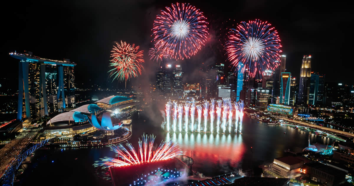
(Header image credits Urban Redevelopment Authority)


Leave a Reply